-
 IntroducingLogisticaThe leading mobile solution to providing
Logistic Support to Your Field OperationsAre you managing a mobile, highly distributed workforce? But...Losing sight of field operations?Needing inter-field operation logistics in real time?Leveraging Geospatial technologies to their maximum benefit?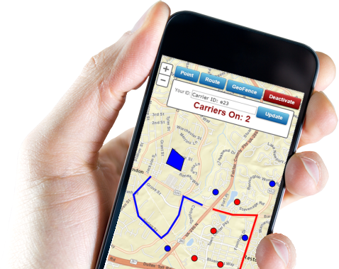
-

Real Time Dynamic Rerouting from nuvoleUS on Vimeo.
The fastest way to grow your business with the leader in Technology. Check out our options and features included.
Logistica - The Logistics Solution - For Your Field Operations
Are you facing some of these Challenges?
Are you managing a mobile highly distributed workforce, is this causing you to lose sight of your field operations. Does your organization process critical data both in your HQ as well as in the field which needs to be shared between both audiences? Behind this back drop are you leveraging Geospatial technologies to their maximum benefit
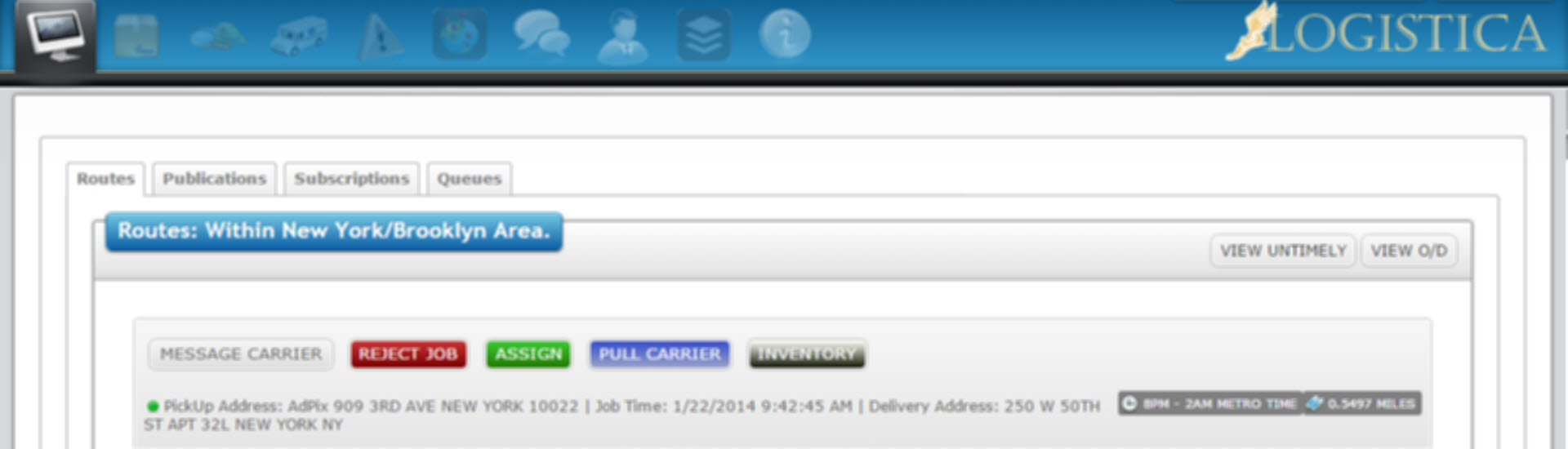
Most large transportation organizations have developed numerous applications and systems that manage their current data and information. Here, GIS plays a pivotal role by helping them integrate their existing systems.
GIS and the use of modern service-oriented architecture (SOA) advance the ability to build enterprise applications and bring together information.
GIS delivers powerful spatial analytics, allowing you to discover patterns and gain intelligence to better understand travel behaviors and perform logistics analysis.
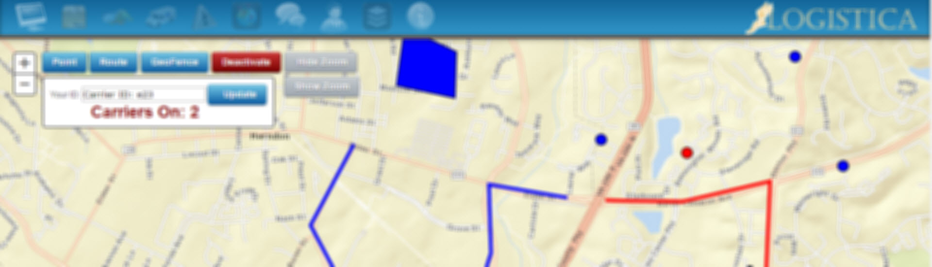
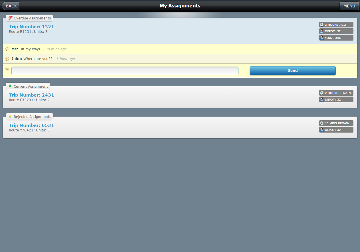
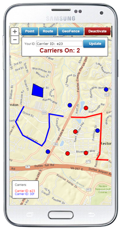
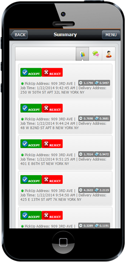
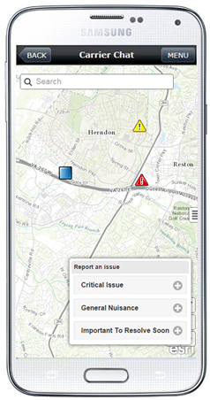
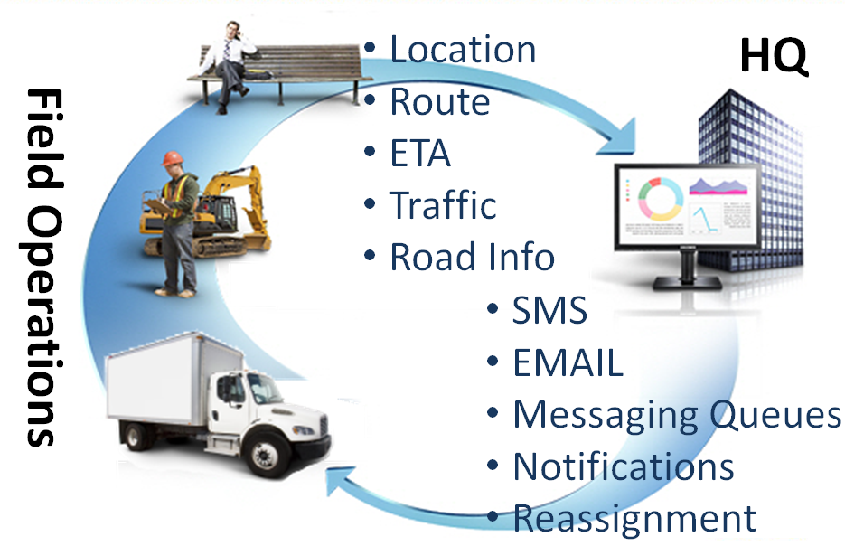
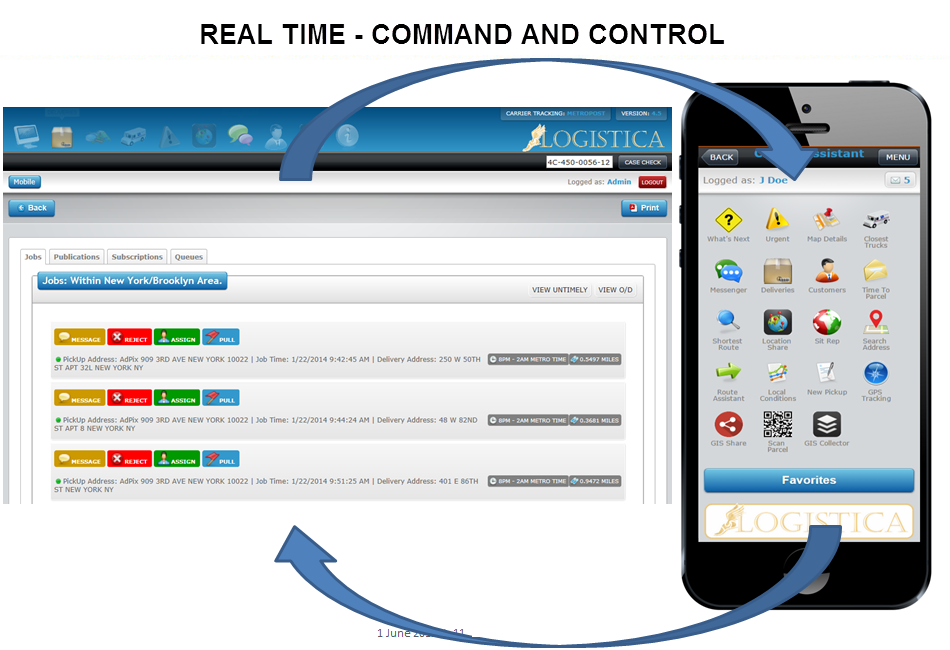
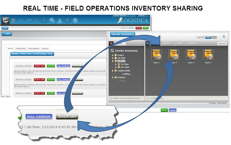
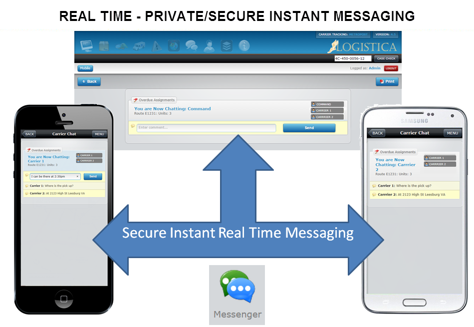
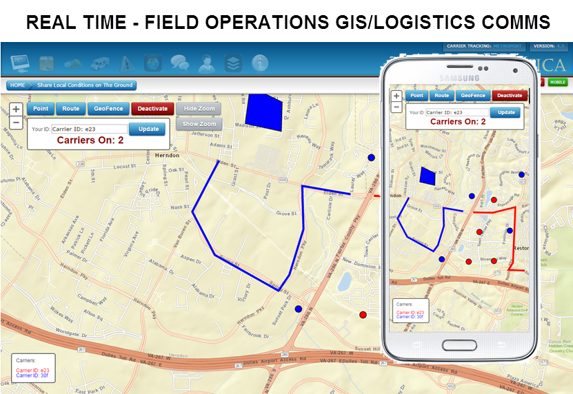
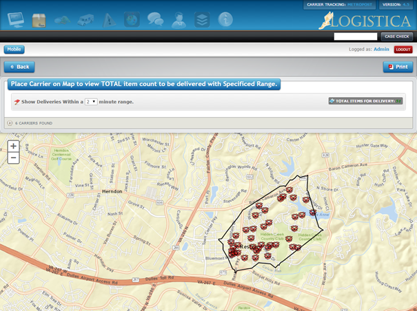
Providing instantaneous bi-directional communication - in real-time without the need for re-posting or refresh. With Mobile/Remote Assets, providing instant messaging, instant map updates of events, etc. viewing location of Mobile/Remote Assets on maps. Filtering of messaging based on geo-fencing.

Solutions
- We have extensive device integration experience.
- ‘Command & Control’ experience.
- Services to manage a highly distributed and mobile business organization.
- A ‘ready to market' capability.
What is Logistica?
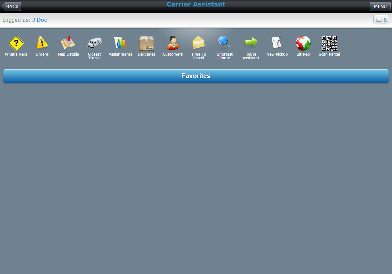
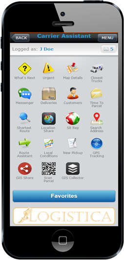
Brings your devices together to paint a single ‘Rich Picture’, at your HQ and in the field. By leveraging our experience you can get the most from your smart mobile devices and integrate them with your smart devices: Hand Scanners, GPS/GIS and data.
Are you managing a mobile highly distributed workforce, is this causing you to lose sight of your field operations. Does your organization process critical data both in your HQ as well as in the field which needs to be shared between both audiences? Behind this back drop are you leveraging Geospatial technologies to their maximum benefit
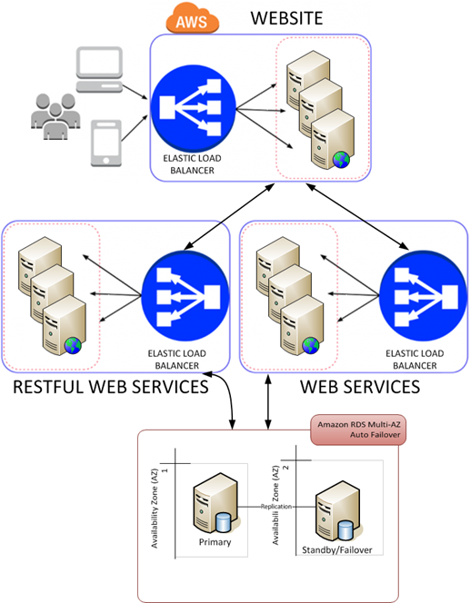
To best assist you in meeting the challenges we at nuvoleUS we provide experience in device intergation to get that remote information back to you HQ. Extensive command and control experience to maximize the productivity of central and field operations. We have existing proven SOA software services to assist you to manage a highly distributed and mobile business organization and get off the ground fast.
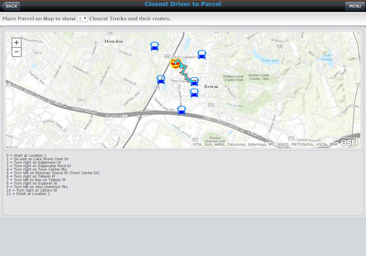
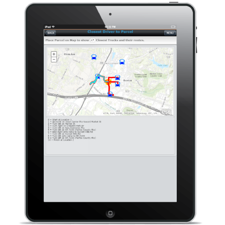
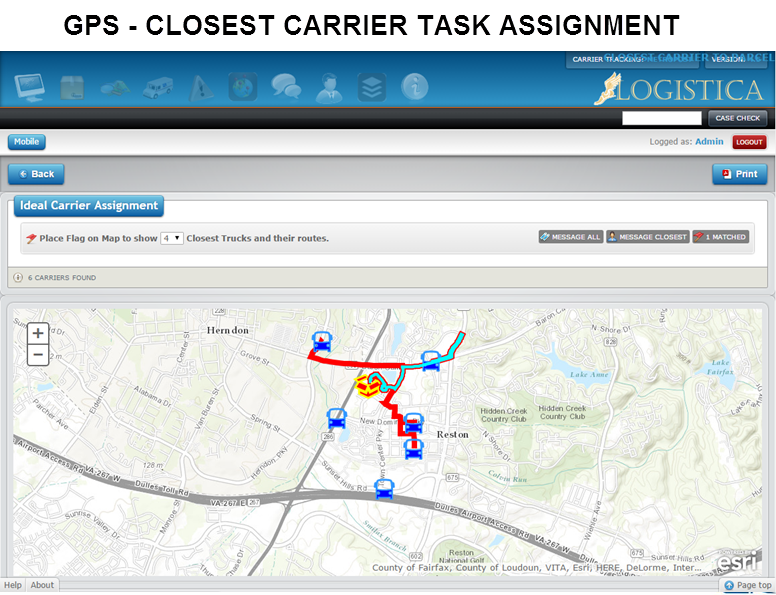
To recap, device integration allows you to readily extract the metadata from the parcel and pass it in real time from any location with an available data connectivity (cellular network, etc) and pass to our purpose build SOA architecture. In turn this information can be presented on any GIS capable hardware; PC, Tablet, Smartphone, GPS Device In turn allowing for dynamic assignment and re-routing.
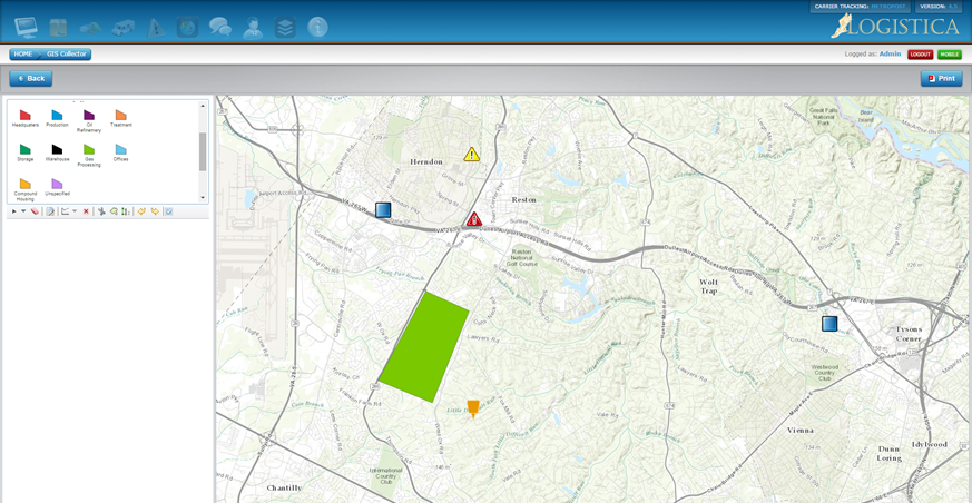
Collect Information from the Field with Logistica
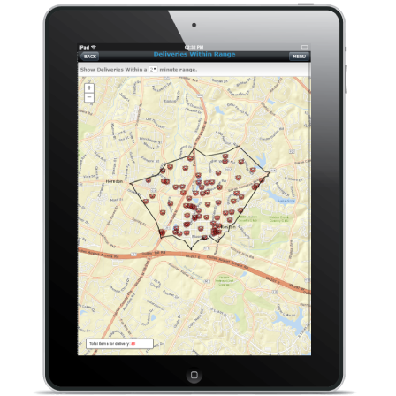
Mobile GIS technology allows transportation maintenance and inspection crews to save time when collecting and updating information from remote locations.
By using GPS and GIS-enabled devices, field crews accurately collect information from the field and seamlessly update corporate databases located in the office in real time.
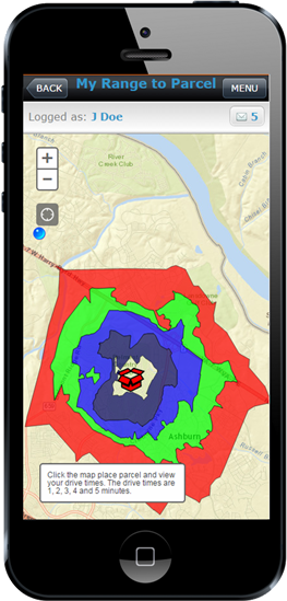
Through GPS and GIS technology, you can track resources and assets in real time, allowing a quick response to any event that requires immediate attention.
You can also more effectively manage mobile resources by instantly seeing the location of any work or inspection crew on a map, then redeploy resources as needed.
Integrate Your Existing Systems and Data with Logistica
Most large transportation organizations have developed numerous applications and systems that manage their current data and information. Here, GIS plays a pivotal role by helping them integrate their existing systems.
GIS and the use of modern service-oriented architecture (SOA) advance the ability to build enterprise applications and bring together information.
GIS delivers powerful spatial analytics, allowing you to discover patterns and gain intelligence to better understand travel behaviors and perform logistics analysis.Request Demo